
Xiao Jian
Add official WeChat: yijianAR for documents & pre-sales support.

Long press the QR code to add customer service
Xiao Jian
Add official WeChat: yijianAR for documents & pre-sales support.
Long press the QR code to add customer service

Urban digital asset management and application

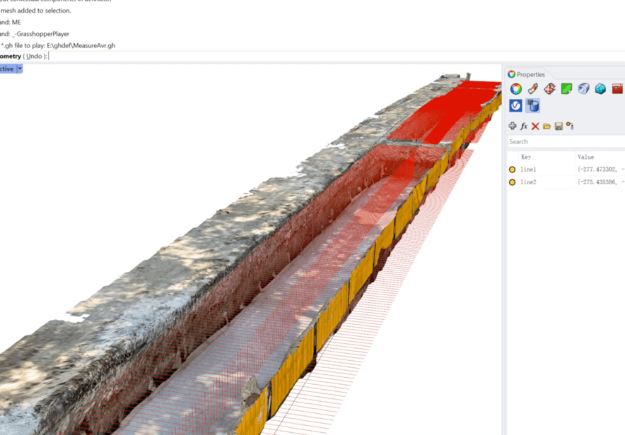
Multi-source data collection and processing
Supporting model data including BIM, point cloud scanning, photogrammetry and panoramic photos.

Spatial positioning and visualization
Obtain the spatial location data through geographic coordinate or feature recognition, and use Beidou, GPS, SLAM to realize model positioning

Fast delivery and deployment
You can not only use Onesight BIM+AR Municipal Platform standardized service, but also request customized development and privatization deployment.
Diversed formats + positioning visualization capabilities to help urban renewal and digital archiving

Intelligent collection of site data
Independent research and development of collection tools for point cloud data, photogrammetry, panoramic photo. Generate low-cost, lightweight image/model data of municipal facilities.
Automatic processing of data inventory
Self-developed 2D/3D modeling tools with automatic processing capabilities adapted to various 3D data. Process massive municipal data inventory efficiently.
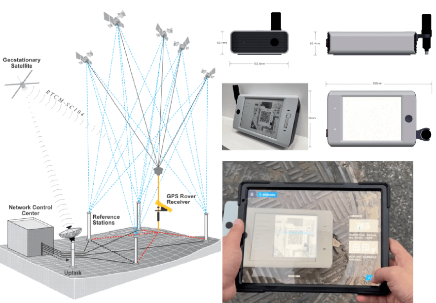
Outdoor centimeter-level positioning and visualization
Equiped with self-developed smart RTK positioning hardware based on Beidou, our visualization & application software for 3D data of cities constructs digital twin cities based on geographic information.
Customized applications and data deployment
In addition to Onesight BIM+AR Municipal Platform applications, we also provide customize functional applications and data privatization deployment based on business characteristics to meet the needs of digital transformation of urban management.
More reliable data application
7X
Throughout the process of construction, operation and maintenance, voluminous and multi-source real City data is recorded and restored in detail. The dependence on model data is 7 times that of traditional methods.
More accurate operation and maintenance
75%
The areas at issue of large-scale projects are spotted quickly. Quality check orders are linked to the models directly. Repeated reporting and responsibility shirking are avoided. Operating cost is reduced by 75%.
More efficient co-working
50%
On-site construction can be managed remotely for it can be viewed at any angle from anywhere in real time. Response time for problem handling is reduced by over 50% .